Black Mesa Summit Trail
Back to Explore
Shop the OkieX Store
Hidden Places· High Point Hike
Must Visit
Black Mesa Summit Trail
Kenton, Oklahoma· Cimarron County· Red Carpet Country
A long hike to Oklahoma's highest point.
From the OkieX Shop
Black Mesa After Dark Tee
$25.00 – $33.00
Shop this piece →Love exploring Oklahoma?
Shop the OkieX merch — tees, stickers and road-trip gear made for people who take the long way home.
OkieX 1907 Heritage Tee
$23.00 – $31.00
Destination Guide
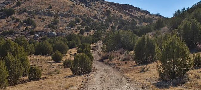
The Black Mesa Summit Trail leads to Oklahoma's highest point, 4,973 feet above sea level, in the far western Panhandle near the New Mexico border. The route crosses open shortgrass prairie before climbing onto the flat-topped mesa, a landscape that feels more closely related to northeastern New Mexico than to most of Oklahoma.
The mesa is capped by resistant volcanic basalt formed from ancient lava flows, which protected the softer rock beneath it from erosion. That geology created the elevated tableland and the dramatic contrast with the surrounding plains.
The hike is long and exposed, with little shade and large temperature swings depending on season and time of day. Water, sun protection and weather awareness are essential, and summer heat can be severe. The summit itself is marked rather than dramatically peaked, but the expansive views and sense of remoteness are the reward. For hikers, the trail is both a high-point challenge and one of the best ways to experience the unusual geology and wide-open scale of the Oklahoma Panhandle.
Location & Contact
Black Mesa Preserve trailhead, Kenton, Oklahoma 73946.0
Hours, pricing, and availability may change. We recommend confirming details directly with the destination before traveling.